
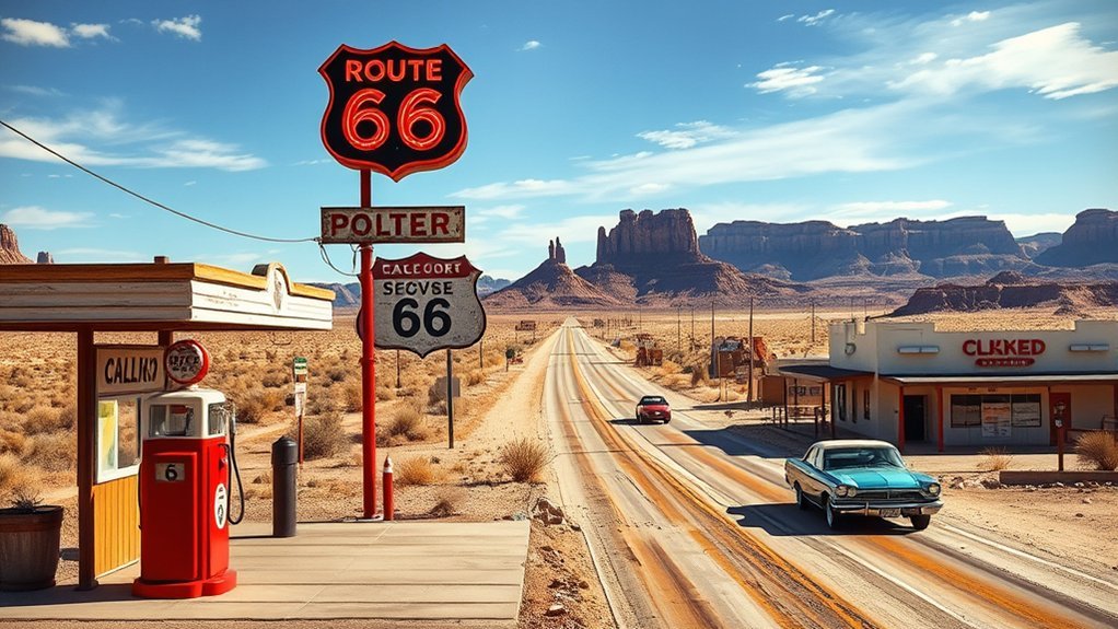
A Route 66 road trip follows more than 2,400 miles of American history from Chicago toward the Pacific Coast. The journey now uses surviving historic alignments, city streets, frontage roads, scenic byways, and interstate connectors rather than one continuous federal highway. Good planning is essential if you want to see the classic diners, neon signs, small towns, national parks, and roadside landmarks without rushing past them.
Quick Answer
Allow at least 10 to 14 days for a Route 66 road trip, and use two to three weeks for a more relaxed journey. Build your route with historic maps, current GPS directions, and state road-condition reports. Late spring and early fall often provide comfortable travel, but weather varies greatly across the eight Route 66 states.
Key Takeaways
- Historic Route 66 is a network of surviving alignments, not one uninterrupted modern highway.
- Ten to 14 days works for major highlights; two to three weeks gives small towns and museums more time.
- Use an official Route 66 map, offline navigation, and current state road reports together.
- Inspect your tires, cooling system, fluids, battery, spare tire, and safety equipment before departure.
- Calculate fuel, lodging, meals, rental fees, parking, and attractions from live prices rather than relying on a fixed trip estimate.
- Route 66 turns 100 in 2026, so centennial events may increase demand for lodging and popular attractions.
At a Glance
| Time Required | 10–14 days for major highlights; 2–3 weeks for a relaxed trip |
| Difficulty | Moderate because of the distance, changing alignments, weather, and daily logistics |
| Tools Needed | Historic map, offline GPS, current road reports, vehicle emergency kit, tire gauge, charger, and water |
| Cost | Varies widely; calculate from live lodging, rental, fuel, food, parking, and attraction prices, then add a 10%–15% reserve |
2026 Planning Note: Route 66 is celebrating its centennial throughout 2026. Check the official Route 66 Centennial event calendar before choosing dates, because festivals and special events may affect lodging availability, traffic, and attraction hours.
The History and Modern Status of Route 66
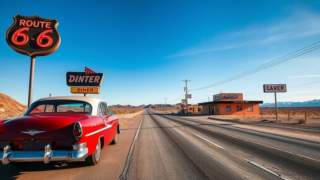
Route 66 was established on November 11, 1926, as part of the early numbered U.S. highway system. It connected Chicago with Los Angeles through Illinois, Missouri, Kansas, Oklahoma, Texas, New Mexico, Arizona, and California. Santa Monica Boulevard joined the western alignment in 1936, creating the familiar ending near the Pacific.
The highway was not fully paved at first. State and federal improvement projects continued until Route 66 became fully paved in 1938. The road then grew into an important route for commerce, migration, military transportation, and postwar tourism. The National Park Service Route 66 history explains how roadside motels, filling stations, restaurants, and other independent businesses developed to serve increasing traffic.
During the Great Depression, many families traveled west in search of work and stability. During World War II, the corridor helped move military personnel, supplies, and defense-industry workers. After the war, growing car ownership changed Route 66 into a symbol of vacation travel and personal mobility.
The Interstate Highway System gradually bypassed Route 66. Portions were replaced by I-55, I-44, I-40, I-15, and I-10. After the final bypass was completed, U.S. 66 was officially removed from the federal highway system on June 27, 1985. The Federal Highway Administration Route 66 fact sheet provides a concise history of that transition.
Modern Route 66 is best understood as a historic corridor with several alignments, not as one continuous highway that can be followed by a single road number.
Travelers can still drive many surviving sections. However, the route may shift between old pavement, local streets, scenic byways, frontage roads, and nearby interstates. Some early sections are abandoned, unpaved, closed, or located on private property.
Route 66 also passes through living communities with Native American, Hispanic, Black, immigrant, agricultural, industrial, and roadside-business histories. A responsible trip looks beyond nostalgia and supports the people, museums, family businesses, and cultural sites that continue to shape the corridor.
How to Plan and Navigate Route 66
Successful Route 66 navigation requires more than entering “Route 66” into a phone. Modern mapping services often select the fastest interstate route, while a historic guide may direct you toward an alignment that is no longer suitable for ordinary vehicles.
Choose Your Travel Direction
Most travelers drive west from Chicago toward Santa Monica because this follows the road’s best-known migration and vacation story. Westbound travel also creates a natural finish at the Pacific Ocean.
Driving east is equally possible and may work better for flight prices, rental-car availability, or personal schedules. The important point is to build the itinerary in one direction rather than repeatedly backtracking between attractions.
Use Historic and Current Maps Together
Start with the National Park Service Route 66 planning resources. The NPS offers printable and interactive maps, historic-site information, and connections to national park units along the corridor.
Then complete these steps:
- Select the alignment you want to follow. Some cities and states have an early alignment, a later alignment, and a bypass alignment.
- Mark your overnight stops. Choose towns with reliable lodging, fuel or charging, food, and late check-in options.
- Add priority attractions. Confirm opening days and allow extra time for museums, parks, city traffic, and photography.
- Download offline maps. Mobile service can be unreliable in desert and rural areas.
- Carry a paper or printed route map. It provides a backup if your phone overheats, loses power, or cannot connect.
- Check road conditions every morning. Use the appropriate state transportation or 511 service for closures, construction, flooding, snow, or wildfire impacts.
Follow Historic Route Signs With Care
Many areas use Historic Route 66 shields or brown heritage signs, but sign colors and coverage are not consistent across all eight states. Signs may disappear at city limits, complex intersections, or sections where the old road no longer carries through traffic.
Use the signs as confirmation rather than your only navigation system. Compare them with your historic map and current road information.
Pro Tip: Plan each day as a short series of towns and landmarks instead of asking your navigation app to route the entire Chicago-to-Santa Monica trip at once. Short segments make it easier to stay on the historic road and recover from a missed turn.
Warning: Do not enter a road simply because an old map labels it Route 66. Stop if you encounter a gate, private-property sign, washout, deep sand, standing water, or a surface that exceeds your vehicle’s ability. Never drive around a closure or barricade.
When Is the Best Time for a Route 66 Road Trip?
No single month guarantees ideal weather across the full route. Chicago, the Ozarks, the southern Great Plains, high-elevation New Mexico and Arizona, and the California desert can experience very different conditions on the same day.
| Season | Advantages | Main Concerns |
|---|---|---|
| Spring | Milder desert temperatures, longer daylight, and green Midwest scenery | Severe thunderstorms, tornado risk, flash flooding, wind, and late snow at elevation |
| Summer | Most attractions are open, school schedules are easier, and daylight is long | Extreme desert heat, larger crowds, higher demand, monsoon storms, and vehicle cooling stress |
| Early Fall | Often comfortable temperatures, fall color in eastern states, and lighter traffic after summer | Shorter daylight, event-related lodging demand, early cold snaps, and wildfire smoke or closures |
| Winter | Lower demand at some stops and dramatic desert scenery | Snow and ice in the Midwest and at higher elevations, reduced attraction hours, and short daylight |
Late May, early June, September, and early October are popular planning windows because they may avoid the most intense desert heat and the busiest part of summer. Even then, check the forecast and road conditions for the next day’s section rather than relying on a seasonal average.
Event Note: The 2026 Albuquerque International Balloon Fiesta is scheduled for October 3–11, 2026. It can be a memorable addition to a fall Route 66 trip, but Albuquerque lodging, parking, and traffic require early planning. Confirm the current schedule through the official Balloon Fiesta website.
How Long Should a Route 66 Road Trip Take?
A full Route 66 trip can be driven quickly, but the purpose of the journey is to experience the places along the road. Allow time for old alignments, museums, meals, conversations, photographs, detours, and unexpected closures.
| Duration | What to Expect |
|---|---|
| 7 Days | A fast highlights trip with long driving days, limited museums, and frequent use of interstates. |
| 10–14 Days | A practical first trip with major attractions, selected historic alignments, and several shorter sightseeing days. |
| 2–3 Weeks | A relaxed trip with small towns, museums, local restaurants, scenic detours, and flexible weather days. |
| 1 Month | A deep exploration of multiple alignments, cultural sites, national parks, and side trips. |
Try to keep most driving days below six hours behind the wheel. Historic-route mileage takes longer than interstate mileage because of traffic signals, lower speed limits, stops, and navigation changes.
Sample 14-Day Route 66 Itinerary
| Day | Suggested Route and Overnight Area |
|---|---|
| 1 | Explore Chicago’s historic starting area, then drive toward Springfield, Illinois. |
| 2 | Springfield, Illinois, to St. Louis, with time for small-town stops. |
| 3 | St. Louis and the Missouri corridor; overnight near Springfield, Missouri. |
| 4 | Cross the short Kansas section and continue to Tulsa. |
| 5 | Tulsa to Oklahoma City with roadside landmarks and museums. |
| 6 | Oklahoma City to Amarillo, including the Texas Panhandle. |
| 7 | Amarillo to Tucumcari or Santa Fe, depending on your preferred New Mexico alignment. |
| 8 | Explore Santa Fe or Albuquerque and the historic urban alignments. |
| 9 | Albuquerque to Gallup, with time for museums and local businesses. |
| 10 | Gallup through Petrified Forest National Park to Winslow or Flagstaff. |
| 11 | Use Williams as a base for Route 66 sightseeing or a Grand Canyon side trip. |
| 12 | Williams or Seligman to Kingman, with Oatman if road and weather conditions allow. |
| 13 | Kingman through the Mojave corridor toward Barstow or the Los Angeles area. |
| 14 | Complete the urban California alignment and finish in Santa Monica. |
Keep one day flexible when possible. A buffer day can absorb severe weather, mechanical trouble, an unexpected closure, or a place you decide deserves more time.
Vehicle Preparation and Road Safety
Route 66 includes crowded city streets, fast interstates, quiet rural roads, high elevations, and hot desert sections. Your vehicle should be ready for all of them.
Before departure, follow the National Highway Traffic Safety Administration road-trip guidance and check:
- Tire pressure: Use the pressure listed on the driver-door label or in the owner’s manual, not the maximum printed on the tire.
- Tire condition: Inspect tread, sidewalls, uneven wear, cracks, bulges, and the spare tire or repair kit.
- Safety recalls: Search your VIN through the official NHTSA recall lookup before the trip.
- Cooling system: Check coolant condition, level, hoses, and signs of leaks when the engine is completely cool.
- Fluids: Verify oil, brake fluid, transmission fluid where applicable, and windshield-washer fluid.
- Battery and charging system: Test an aging battery before crossing remote or high-heat areas.
- Brakes, lights, and wipers: Repair worn or unreliable components before departure.
- Insurance and roadside assistance: Confirm coverage, towing limits, and rental-car procedures.
Warning: Never open a hot radiator or pressurized coolant reservoir. Allow the engine to cool and follow the vehicle manufacturer’s instructions. If the temperature warning appears, safely leave traffic, switch off the engine, and arrange professional help when needed.
Prepare for Remote Stretches
Carry drinking water, a charged phone, charging cable, flashlight, first aid kit, reflective warning device, jumper cables or a jump pack, tire gauge, inflator, basic tools, sun protection, and an emergency blanket. Keep important phone numbers and reservation details available offline.
Refuel before entering a remote desert section rather than waiting for the fuel warning light. Station hours can change, and a historic map may show businesses that no longer operate.
EV drivers should verify charger status through more than one current source, identify backup chargers, and allow a larger range reserve during extreme heat, cold, wind, elevation changes, or long detours. Do not assume that a charger shown on an old Route 66 guide is active or accessible at all hours.
Weather, Fatigue, and Closure Safety
- Check forecasts and official state road conditions before leaving each morning.
- Do not drive through floodwater, around barricades, or into a dust storm with near-zero visibility.
- Take regular breaks and change drivers when possible.
- Stop for the night if you are fighting sleep, repeatedly missing signs, or drifting within the lane.
- Carry extra water in the desert, but do not leave people or pets inside a parked vehicle.
- Adjust your route for wildfire, smoke, snow, high wind, or extreme-heat advisories.
Packing Essentials for Your Route 66 Adventure
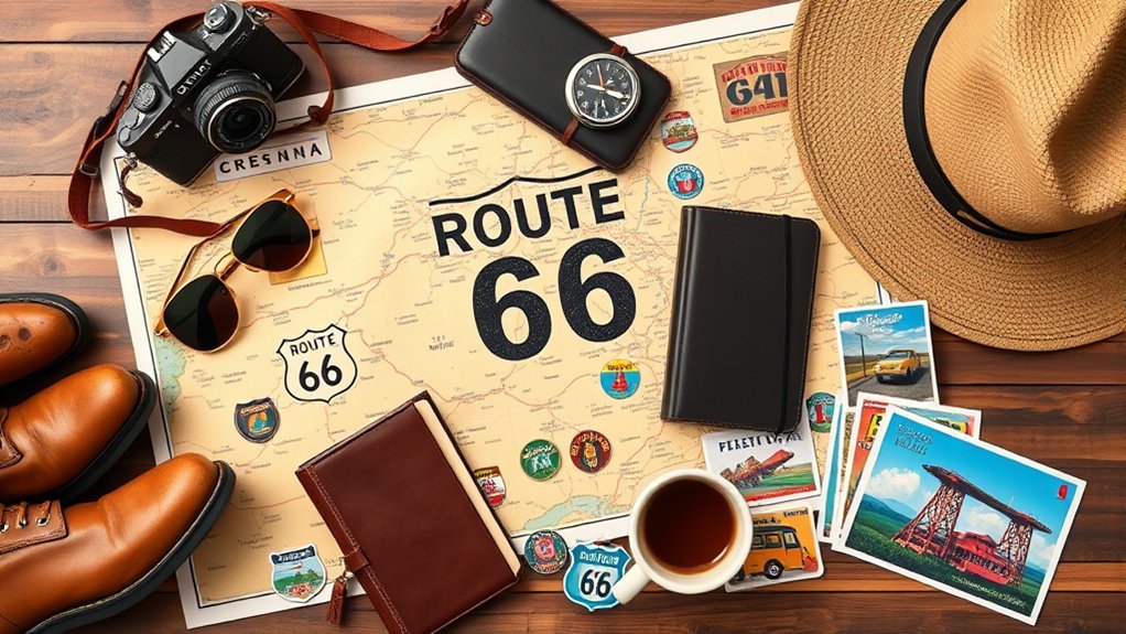
Route 66 crosses several climates, so pack layers rather than clothing for only one temperature range. Cool mornings at higher elevations can occur even when lower desert areas are hot.
Personal Packing List
- Comfortable walking shoes or trail shoes
- Lightweight shirts and breathable warm-weather clothing
- Warm layer for evenings and high elevations
- Rain jacket
- Hat, sunglasses, and sunscreen
- Reusable water bottles
- Daily medication and copies of prescriptions
- Small cooler for drinks and food
- Camera, phone, charging cables, and power bank
- Basic toiletries and hand-cleaning supplies
Vehicle and Navigation Packing List
- Printed Route 66 map or guide
- Downloaded offline maps
- First aid kit
- Flashlight or headlamp
- Tire gauge and portable inflator
- Spare tire, jack, lug wrench, or manufacturer-approved repair kit
- Jumper cables or jump pack
- Reflective vest and warning triangles
- Emergency water and nonperishable snacks
- Paper towels, trash bags, and reusable shopping bags
- Blanket and seasonal emergency clothing
Keep emergency equipment accessible. A tire inflator buried beneath two weeks of luggage will be difficult to reach safely on a roadside shoulder.
How to Budget for a Route 66 Road Trip
A Route 66 budget should be built from current prices for your exact dates. Centennial events, holidays, city weekends, insurance choices, and one-way rental fees can change the final cost substantially.
Route 66 Budget Formula
Use this calculation:
Total trip budget = transportation + lodging + food + attractions + parking and tolls + emergency reserve.
| Category | How to Calculate It |
|---|---|
| Rental Vehicle | Compare the total checkout price, including taxes, insurance, mileage terms, airport charges, and one-way drop fees. |
| Fuel | Planned miles ÷ vehicle mpg × expected average fuel price. Add mileage for city driving and detours. |
| EV Charging | Estimate energy use from planned miles and vehicle efficiency, then check current network and hotel charging prices. |
| Lodging | Multiply the complete nightly rate, including taxes and parking, by the number of nights. |
| Food | Set a daily amount per traveler. Mix local restaurants with grocery-store breakfasts, picnic lunches, and cooler snacks. |
| Attractions | List paid museums, park entrance fees, tours, tram tickets, and reserved experiences separately. |
| Contingency | Add 10%–15% for repairs, schedule changes, replacement lodging, parking, and unexpected detours. |
Pro Tip: Compare a daily rental price with the final total before booking. A low advertised rate can become expensive after taxes, insurance, airport charges, and a one-way drop fee are added.
Must-See Route 66 Stops by State
Every state offers a different part of the Route 66 story. Choose a few priority stops each day instead of trying to visit every landmark.
| State | Ideas for Your Itinerary |
|---|---|
| Illinois | Chicago starting markers, Joliet, Pontiac, restored filling stations, Springfield, and classic roadside food stops. |
| Missouri | Gateway Arch National Park, Route 66 State Park, Cuba murals, rolling Ozark sections, and Springfield. |
| Kansas | The short southeastern Kansas alignment through Galena, Riverton, and Baxter Springs. |
| Oklahoma | The Blue Whale of Catoosa, Tulsa, restored roadside architecture, Oklahoma City, and Route 66 museums. |
| Texas | Shamrock, Amarillo, Cadillac Ranch, the Big Texan, and the midpoint area near Adrian. |
| New Mexico | Tucumcari neon, Santa Fe’s older alignment, Albuquerque’s Central Avenue, Grants, and Gallup. |
| Arizona | Petrified Forest National Park, Winslow, Flagstaff, Williams, Seligman, Kingman, and Oatman. |
| California | Needles, Mojave Desert communities, Amboy, Barstow, San Bernardino, Pasadena, Los Angeles, and Santa Monica. |
Budget-Conscious Route 66 Attractions
- Gateway Arch National Park, St. Louis: The 630-foot Arch is an iconic stop. The museum and Old Courthouse are free, but the Tram Ride to the Top requires a paid timed ticket and may sell out. Review current prices and accessibility details on the official Gateway Arch fee page.
- Blue Whale of Catoosa, Oklahoma: This outdoor roadside landmark is a popular photography stop. Confirm current access and hours before arrival.
- Big Texan Steak Ranch, Amarillo: Visitors can stop for a meal or watch the famous challenge. The challenge is not automatically free; participants pay unless they complete every required item within the official time and rules. Check the current Big Texan challenge rules.
- Cadillac Ranch, Amarillo: The outdoor art installation is known for its paint-covered cars. Follow posted access rules, remain in permitted areas, and take empty paint cans and other trash with you.
- Petrified Forest National Park, Arizona: The park includes Painted Desert scenery, historic Route 66 interpretation, trails, and a 28-mile park road. Check current hours, fees, weather, and itineraries through the official Petrified Forest National Park website.
- Route 66 State Park, Missouri: The park preserves Route 66 and former Times Beach history near St. Louis. Confirm visitor-center hours on the official Missouri State Parks page.
Is the Grand Canyon on Route 66?
Grand Canyon National Park is not directly on Route 66. The South Rim is about 60 to 63 miles north of Williams, Arizona, by Highway 64. Treat it as a separate half-day or full-day side trip and check the official Grand Canyon directions and road conditions.
Travel Responsibly Along Route 66
Many Route 66 landmarks are beside homes, working ranches, businesses, tribal lands, active railways, and ordinary city streets. Historic importance does not create a right to enter private land.
- Obey gates, barriers, parking rules, and no-trespassing signs.
- Ask before photographing people or private interiors.
- Follow posted rules on tribal lands and at cultural sites.
- Do not remove artifacts, stones, signs, or pieces of abandoned structures.
- Buy food, fuel, lodging, tickets, and souvenirs from local businesses when possible.
- Pack out trash, including spray cans and disposable food containers.
- Do not stop in a traffic lane for photographs.
Frequently Asked Questions
What are the best scenic viewpoints near Route 66?
Popular scenic areas include the Painted Desert and overlooks within Petrified Forest National Park, desert views in western Arizona and California, and sections of the Ozarks in Missouri. Grand Canyon National Park is an excellent side trip, but it is not directly on Route 66.
Are guided Route 66 tours available?
Yes. Options include escorted motor-coach tours, motorcycle tours, self-drive packages, local walking tours, and museum-led programs. Verify the operator’s current itinerary, cancellation terms, insurance requirements, group size, and whether attraction admissions are included.
How can I find good local food along Route 66?
Use current local tourism pages, recent menus, museum recommendations, and advice from motel owners or visitor centers. Check operating days before making a long detour because some historic diners close early or operate only on selected days.
What are some less-crowded Route 66 stops?
Smaller museums, restored filling stations, local murals, short historic road segments, and downtown business districts can be as rewarding as the famous landmarks. Look beyond social-media lists, but verify access before visiting abandoned or isolated sites.
Is there an official Route 66 navigation app?
There is no single federal app that provides complete turn-by-turn navigation for every historic Route 66 alignment. The official NPS App covers National Park Service sites and offers offline park content, while NPS Route 66 pages provide printable and interactive planning maps. Use those resources with current navigation and state road reports.
Can the entire original Route 66 still be driven?
No. Many sections remain drivable, but some old alignments are abandoned, closed, unpaved, interrupted, or located on private property. A complete modern trip uses a mixture of historic road, local streets, frontage roads, and interstate connectors.
Should I drive Route 66 eastbound or westbound?
Westbound from Chicago is the traditional choice and ends near the Pacific in Santa Monica. Eastbound works just as well when flights, rental-car rates, weather, or your schedule favor starting in California.
How many days do I need for Route 66?
Allow 10 to 14 days for major highlights. Two to three weeks is better for travelers who want museums, small towns, historic alignments, local meals, and side trips without long driving days.
Conclusion
A memorable Route 66 road trip starts with a realistic schedule, a reliable vehicle, several forms of navigation, and room for unexpected stops. Use 10 to 14 days for the major highlights or two to three weeks for a slower journey. Check weather, closures, attraction hours, and reservations as you travel, especially during the 2026 centennial. The road’s lasting appeal comes not only from its famous signs and roadside attractions, but also from the communities and stories found between them.
Sources
- National Park Service — Route 66 Overview — route history, migration, wartime use, preservation, and surviving alignments
- National Park Service — Plan Your Route 66 Visit — official maps, historic places, and national park planning resources
- Federal Highway Administration — Route 66 Fact Sheet — interstate replacement and 1985 decommissioning
- National Highway Traffic Safety Administration — Road Trip Safety — tire, cooling-system, fluid, battery, and emergency preparation
- Official U.S. Route 66 Centennial — 2026 centennial information and events
- Albuquerque International Balloon Fiesta — official 2026 event dates, tickets, parking, and visitor information







Leave a Reply